HELP: SEARCH
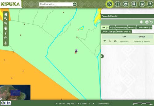
TMK
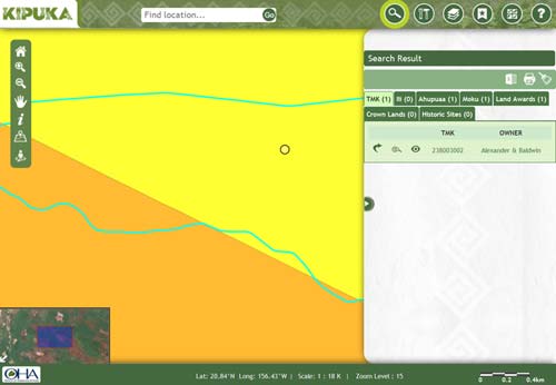
Real property is mapped and indexed numerically according to a Tax Map Key system. Based upon legal descriptions, tax map key constituting of 9 digits help to identify individual pieces of property for tax purposes. By default TMK tab is selected, type a number in the location bar. The autocomplete feature will help you to choose a tax map key by giving you suggestions.
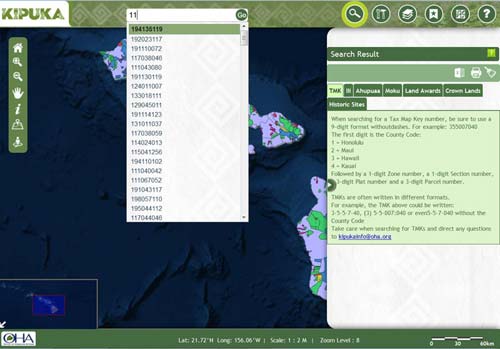
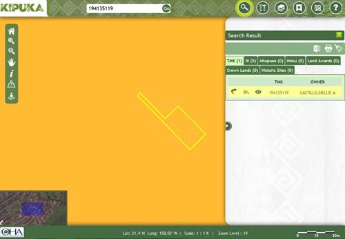
Select the tax map key from the list of suggestions and click Go to get the results. The parcel gets highlighted and the necessary details are furnished.
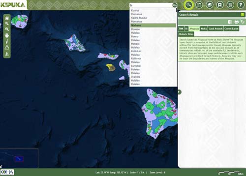
Ili
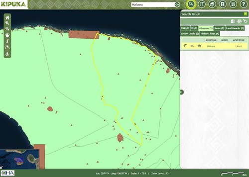
Select Ili tab on search pane, start typing in Ili name or Ahupuaa name in the location bar and autocomplete will give you suggestions to choose from.
Choose the required name and click Go to get the results. The parcel(s) gets highlighted and the necessary details are furnished.
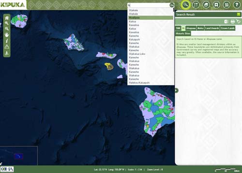
Ahupaa
Select Ahupuaa tab on search pane, type in Moku or Ahupuaa name in the location bar and autocomplete will give you suggestions to choose from.
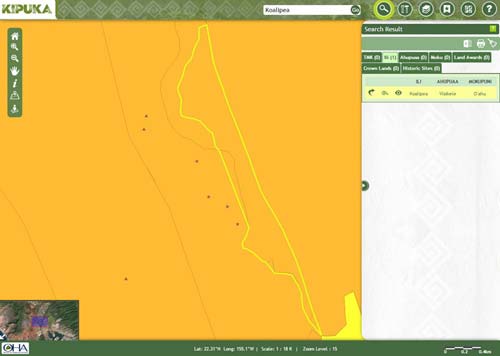
Choose the required name and click Go to get the results. The parcel(s) gets highlighted and the necessary details are furnished.
Moku
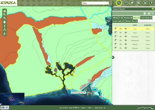
Select Moku tab on search pane, start typing in Mokupani or Moku name in the location bar and autocomplete will give you suggestions to choose from.
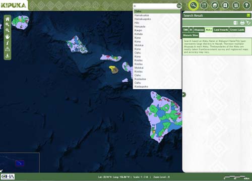
Choose the required name and click Go to get the results. The parcel(s) gets highlighted and the necessary details are furnished.
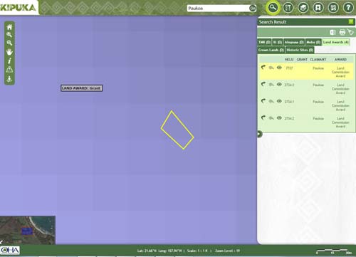
Land Awards
Select Land Awards tab on search pane, type in Helu, Grant number or Claimant name in the location bar and autocomplete will give you suggestions to choose from.
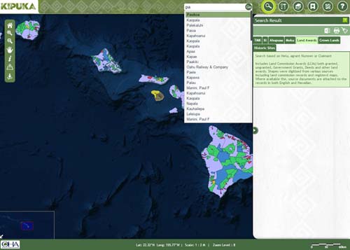
Choose the required name and click Go to get the results. The parcel(s) gets highlighted and the necessary details are furnished.
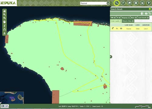
Crown Land
Select Crown Lands tab on search pane, start typing in Mokupani, Moku or Land name in the location bar and autocomplete will give you suggestions to choose from.
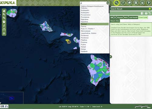
Choose the required name and click Go to get the results. The parcel(s) gets highlighted and the necessary details are furnished.
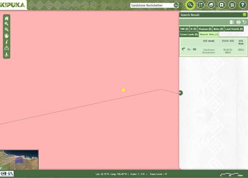
Historic Sites
Select Historic Sites tab on search pane, start typing in place name or state site number in the location bar and autocomplete will give you suggestions to choose from

Choose the required name and click Go to get the results. The parcel(s) gets highlighted and the necessary details are furnished.
HELP: TOOLS
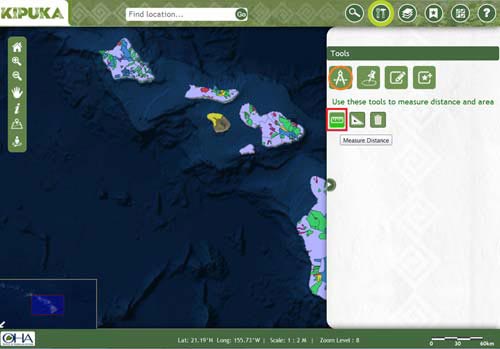
Measuring Tape
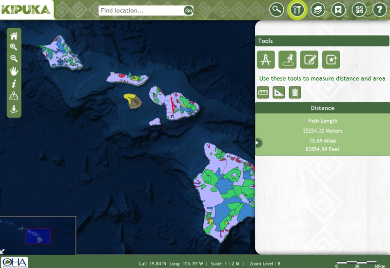
Measure distance
Select the measure distance tool and click on the map and start drawing a line across the distance to be meaured
Double click on the ending point once you are done. The distance gets displayed in the content pane
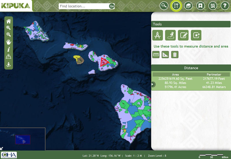
Measure area and perimeter
Select the measure area and perimeter tool and click on the map and start drawing a poylgon
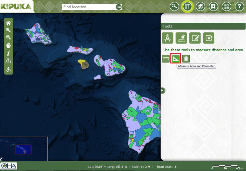
Double click on the ending point once you are done. The area and perimeter gets displayed in the content pane
Click on this icon higlighed below to clear the result and graphics on the map
Buffer
Enter the required distance in the text box and select the unit of distance
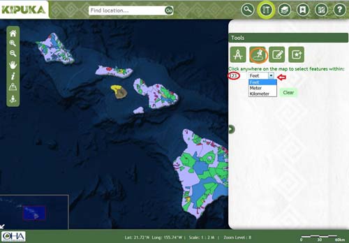
Click on a point on the map and the result shows all features which lie within the specified radius from the clicked point
Note: The clicked point is pin pointed. Click the clear button once done.
Select Feature
Select point
Click on a point on the map
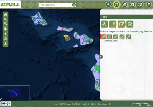
The result displays those selective features which are intersected by the shape.
Select path
Click on a point on the map and drag the cursor to draw a line. Double click on the end point
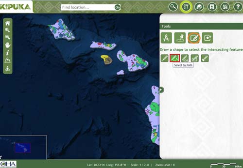
The result displays those selective features which are intersected by the shape.
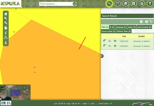
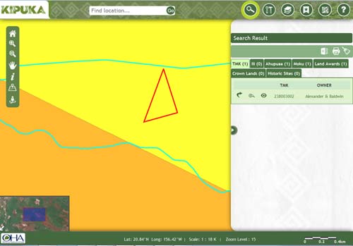
Select polygon
Click on the map and start drawing a poylgon. Double click on the end point once done

The result displays those selective features which are intersected by the shape.
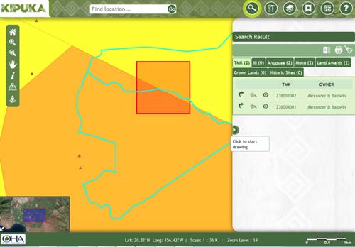
Select rectangle
Click on a point and drag it to draw a rectangle across the area
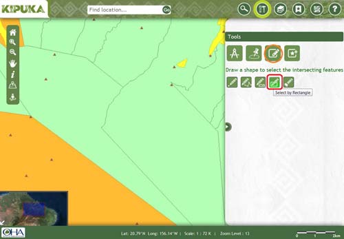
The result displays those selective features which are intersected by the shape.
Clear
Click on this icon to clear the results and shapes
Add Feature
Draw point
Click on a point on the map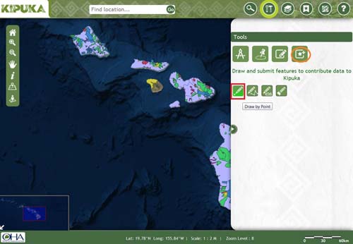
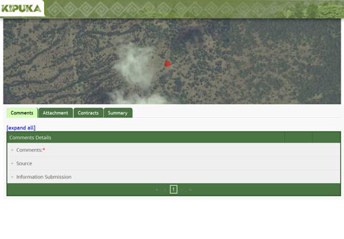
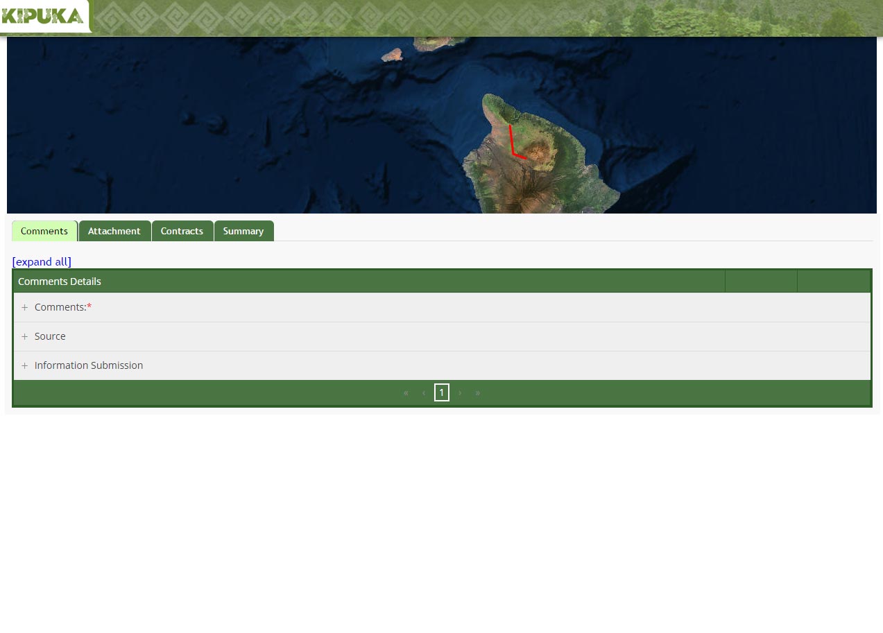
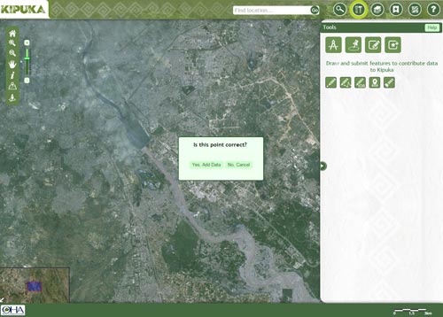
A pop up window opens with option to submit feature to kipuka database.click yes if you are sure of your input.
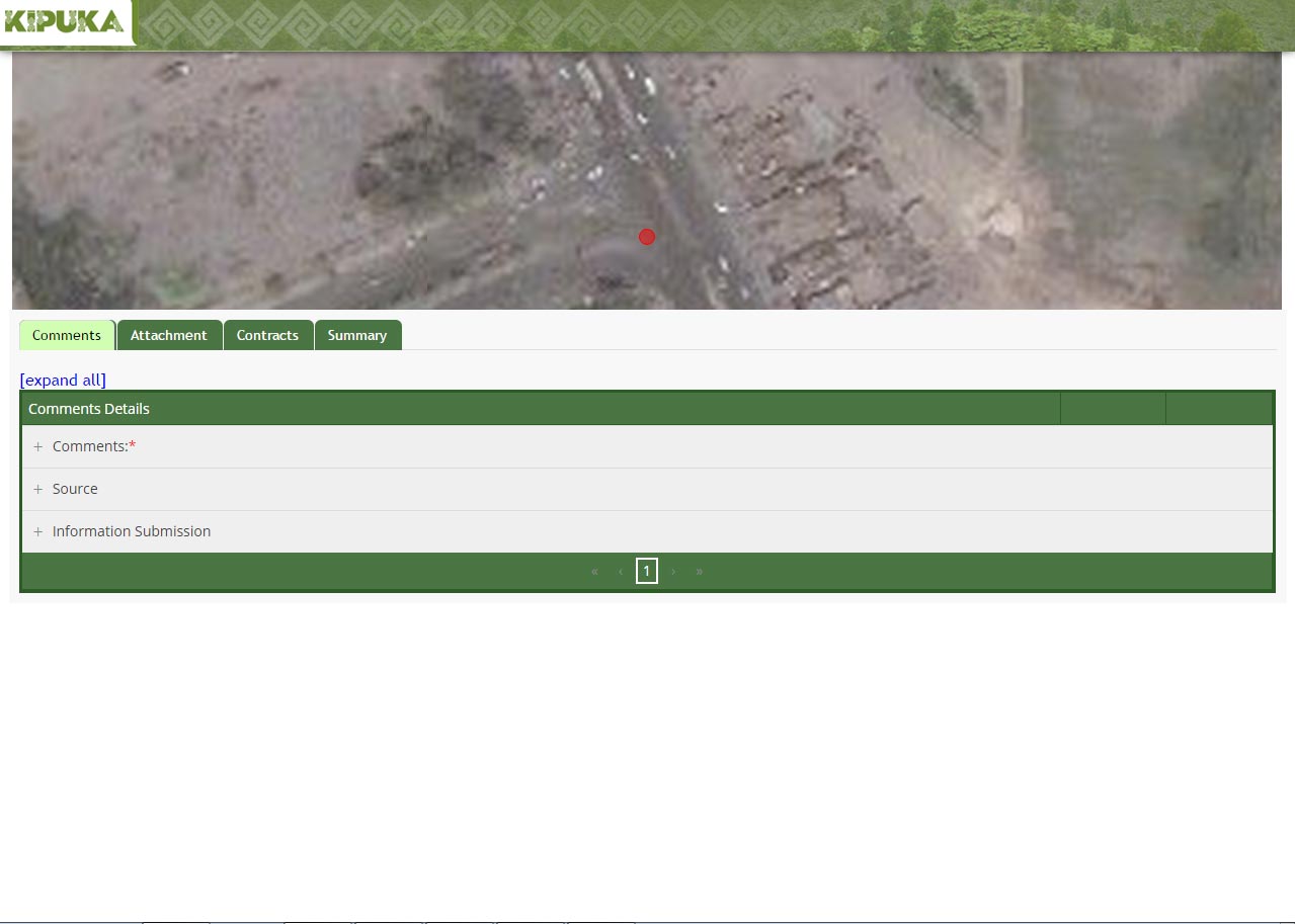
It will redirect you to a page where after filling in the necesserry details, you can submit the feature.
Draw path
Click on a point on the map and drag the cursor to draw a line. Double click on the end point

A pop up window opens with option to submit feature to kipuka database.click yes if you are sure of your input.
It will redirect you to a page where after filling in the necesserry details, you can submit the feature.
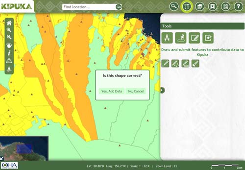
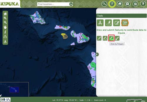
Draw polygon
Click on the map and start drawing a poylgon. Double click on the end point once done
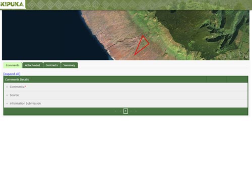
A pop up window opens with option to submit feature to kipuka database.click yes if you are sure of your input.
It will redirect you to a page where after filling in the necesserry details, you can submit the feature.
Locate me
It will locate the user and the user can add his/her location to the database
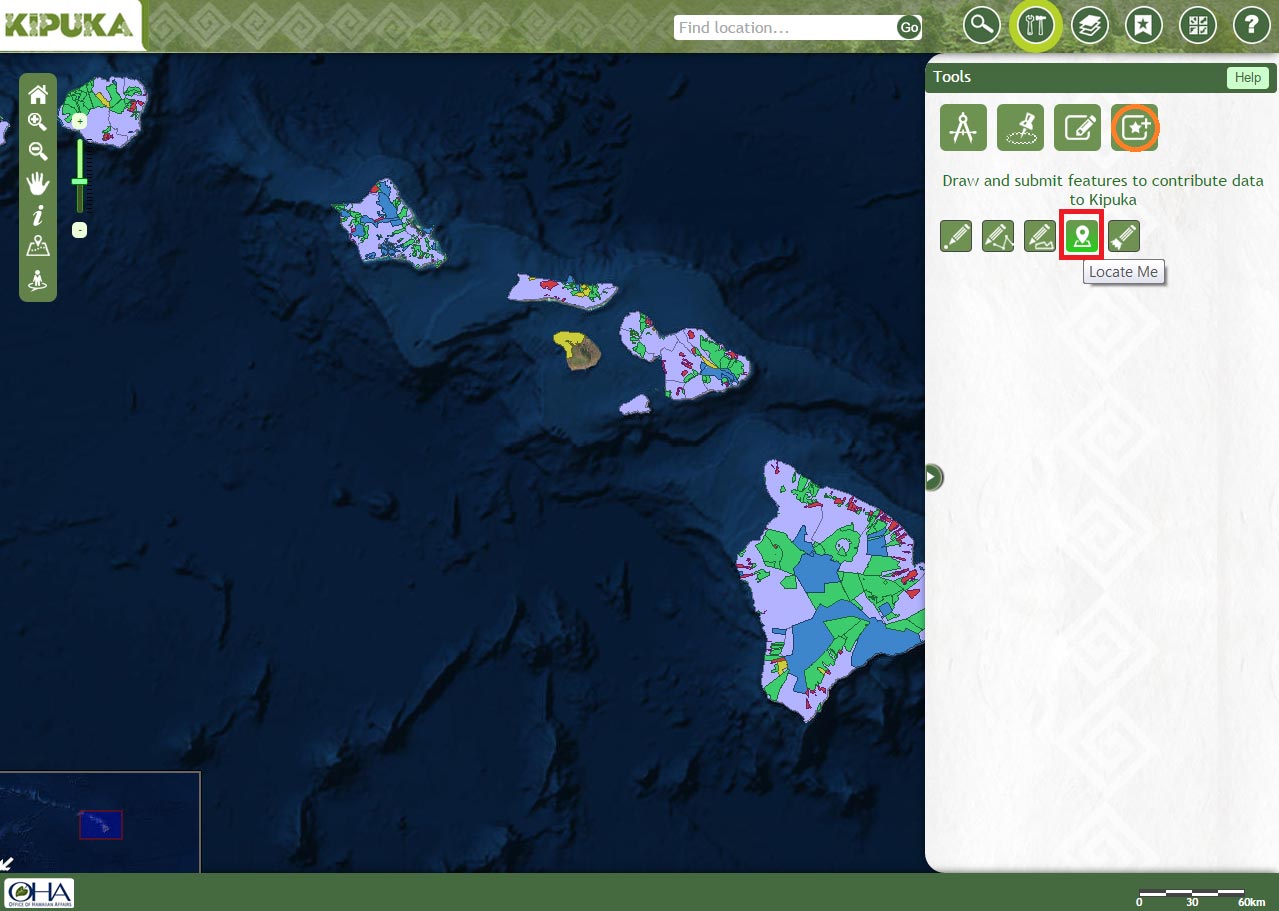
A pop up window opens with option to submit feature to kipuka database.click yes if you are sure of your input.
It will redirect you to a page where after filling in the necesserry details, you can submit the feature.
Clear
Click on this icon to clear the results and shapes